
The night sky is a vast and beautiful map, but without a guide, it can feel like a confusing jumble of dots. A star chart, and its interactive cousin the planisphere, is the key to unlocking that map. Learning to use one is a fundamental skill that transforms you from a passive observer into an active explorer of the cosmos.
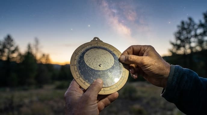
This guide will teach you the basics of reading a star chart and how to use a planisphere to find out exactly what's above you on any given night.
Understanding the Basics of a Star Chart
A star chart is a two-dimensional map of the three-dimensional celestial sphere. It flattens the sky onto a page. At first glance, it can look complex, but the system is quite simple.
- Dots for Stars: The dots on the chart represent stars. The larger the dot, the brighter the star is in the sky.
- Lines and Figures: The lines connecting the dots trace the patterns of constellations, helping you identify them. Sometimes, artistic renderings of the constellation figures are included.
- The Ecliptic: You'll often see a curved or wavy line running across the chart. This is the ecliptic—the apparent path of the Sun, Moon, and planets across the sky throughout the year. If you're looking for planets, they will always be found near this line.
- Other Symbols: Charts often use special symbols to mark other objects of interest, like fuzzy ovals for galaxies, circles for star clusters, and squares for nebulae.
The Planisphere: Your Personal Sky Guide
While a static star chart in a book is useful, a planisphere (or star wheel) is one of the best tools for a beginner. It's a rotating star chart that you can adjust for any date and time to see a map of the sky as it appears at that exact moment.
A planisphere consists of two parts: a circular star map on the bottom layer, and a top layer with a transparent oval window. The edge of the map is marked with the days of the year, and the edge of the top layer is marked with the hours of the day.
How to Use a Planisphere: A Step-by-Step Guide
Using a planisphere is easy once you get the hang of it.
- Set the Date and Time: Hold the planisphere and rotate the top disc until the current date on the bottom wheel lines up with the current time on the top wheel. For example, align 'October 15' with '9 PM'.
- View the Star Map: The oval window now shows all the constellations and stars that are currently visible in your sky. The edge of the oval represents your horizon.
- Orient the Map: To match the map to the sky, you need to know your directions (north, south, east, west). Hold the planisphere over your head with the 'North' on the chart pointing towards true north. The map will then be oriented to match the sky above you. Alternatively, if you are facing south, hold the chart in front of you with the 'South' edge at the bottom.
Tips for Using Charts in the Dark
Reading a map in the dark presents a challenge: you need light to see the chart, but a bright white light will ruin your night vision. The solution is a red flashlight. Red light has a minimal effect on your eyes' dark adaptation, allowing you to switch between looking at your chart and the sky without having to wait for your vision to readjust each time. You can buy a dedicated red astronomy flashlight or simply cover a regular flashlight with a few layers of red cellophane or tape.
FAQ
What's the difference between a constellation and an asterism?
A constellation is one of the 88 officially recognized regions of the sky, like Ursa Major or Orion. An asterism is a popular, recognizable pattern of stars that is not an official constellation, like the Big Dipper (which is part of Ursa Major) or the Summer Triangle.
Why do I need a planisphere specific to my latitude?
Planispheres are designed for a specific range of latitudes (e.g., 30°-40° North) because your location on Earth determines which stars are visible and how they move across your sky. Using a planisphere designed for a different hemisphere won't work correctly.
Are there apps that do the same thing?
Yes, there are many excellent stargazing apps that use your phone's GPS and compass to show you an augmented-reality view of the sky. They are fantastic tools, but learning to use a manual planisphere is a valuable skill that doesn't rely on batteries or a screen.
Key Takeaways
- A star chart is a map of the night sky, showing stars, constellations, and other celestial objects.
- A planisphere is a rotating star chart that you can set to a specific date and time.
- To use a planisphere, align the date with the time to see what's currently in the sky.
- Always use a red flashlight to read your chart in the dark to preserve your night vision.
- The ecliptic is the path of the planets, so look for them along this line on your chart.
Related Reading
- A Beginner's Guide to Finding the North Star
- What Is Light Pollution and How to Escape It
- Choosing Your First Astronomy Binoculars